Mynd:Faroe Islands, Streymoy, abandoned whaling station at Viđ Áir (2).jpg
Jump to navigation
Jump to search


Stødd av hesi forskoðan: 800 × 531 pixels. Aðrar upploysnir: 320 × 213 pixels | 640 × 425 pixels | 1,024 × 680 pixels | 1,280 × 850 pixels | 4,288 × 2,848 pixels.
Upprunafíla (4,288 × 2,848 pixel, stødd fílu: 3.39 MB, MIME-slag: image/jpeg)
.jpg)
Samandráttur
| Frágreiðing |
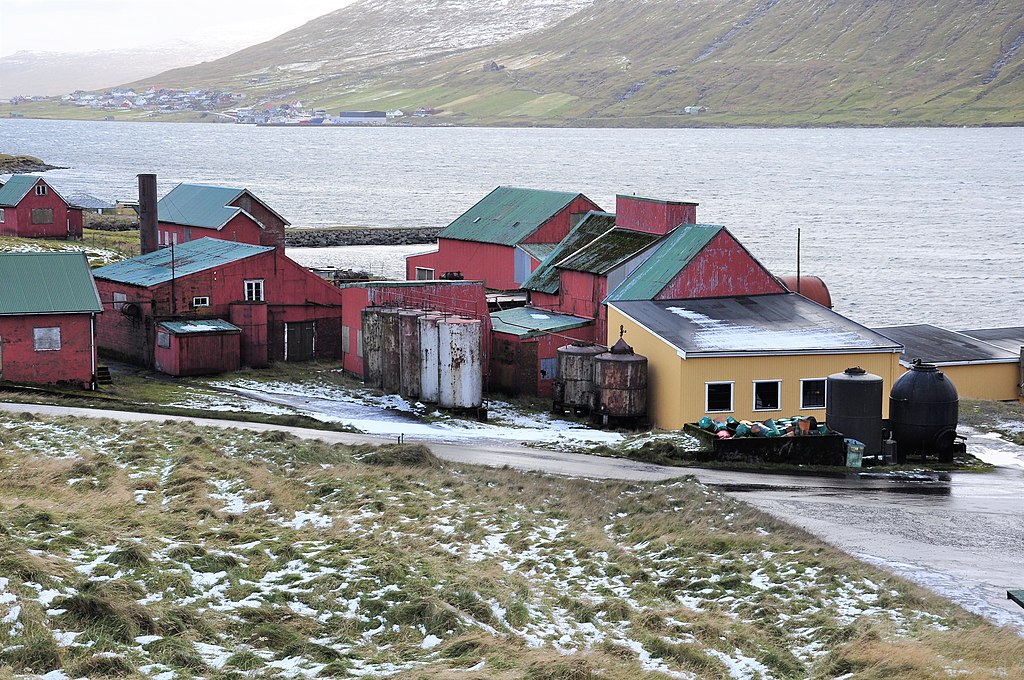
English: Scene at the abandoned whaling station at Við Áir, located between Hósvík and Hvalvík on Streymoy (Faroe Islands).
Nederlands: Het verlaten walvisvangst-station in Við Áir, gelegen tussen Hósvík en Hvalvík op Streymoy (Faröer Eilanden). |
| Dagur | |
| Kelda | Egið verk |
| Høvundur | Vincent van Zeijst |
Looking to the north from:
| Camera location | | View this and other nearby images on: OpenStreetMap |
|---|
.jpg¶ms=062.172343_N_-006.972927_E_globe:Earth_type:camera__&language=fo)
Lisensur
I, the copyright holder of this work, hereby publish it under the following licenses:
This file is licensed under the Creative Commons Attribution-Share Alike 4.0 International license.
- Tú ert vælkomin til:
- at deila – at avrita, breiða út og senda verkið
- at remiksa – at tillaga ella broyta verkið
- Undir hesum treytum:
- ognan – Tú mást ognarskrivað verkið á ein slíkan hátt sum er útgreinaður av høvundanum ella lisenseigaranum (men ikki á nakran hátt ið kundi bent á at hesin hevur góðkent teg ella tína nýtslu av verkinum).
- deil undir somu treytum – Um tú broytir, evnar til ella byggir víðari á hetta verk, so kanst tú bert útgeva verkið undir somu ella líkandi lisensi sum hesin.

|
Loyvi verður givi at avrita, bera út og/ella broyta hetta skjal undir treytunum hjá GNU Free Documentation License, versión 1.2 ella einhvør seinni versjón ið er útgivin av Free Software Foundation; uttan nakað óbroytiligt brot, uttan forsíðutekst og uttan baksíðutekst. Eitt avrit av loyvinum er tikið við í brotinum ið nevnist GNU Free Documentation License. |
Tú kanst velja tann lisens ið tú ynskir.
Søgan hjá fíluni
Trýst á dato/tíð fyri at síggja fíluna, sum hon sá út tá.
| Dagur/Tíð | Lítil mynd | Dimensjónir | Brúkari | Viðmerking | |
|---|---|---|---|---|---|
| streymur | 27. sep 2018 kl. 22:50 | | 4,288 × 2,848 (3.39 MB) | Loranchet | {{Information |description ={{en|1=Scene at the abandoned whaling station at Við Áir, located between Hósvík and Hvalvík on Streymoy (Faroe Islands).}} {{nl|1=Het verlaten walvisvangst-station in Við Áir, gelegen tussen Hósvík en Hvalvík op Streymoy (Faröer Eilanden).}} |date =2010-10-21 |source ={{own}} |author =Vincent van Zeijst }} {{Location|62.173214|-6.972745}} Category:Við Áir Category:Whaling in the Faroe Islands Category:Streymoy [[Category:Whal... |
Nýtsla av fílu
Fylgjandi síða slóðar til hesa fílu:
.jpg)